
Positioning & Surveying Equipment Since 1946
Some of the best conversations in surveying happen when current technology meets the people who will use, teach, and develop it next.
That’s exactly what unfolded when Afgen joined Tshwane University of Technology (TUT) for a Technical Day, bringing modern surveying tools directly to teachers and students.
This blog recaps what happened, why it matters, and how events like these help shape the future of geospatial careers in South Africa.
Technical Day gives industry partners a chance to connect directly with TUT’s teachers and students, moving conversations beyond spec sheets and into real-world application. TUT’s Geomatics and Surveying programme blends fieldwork with computer modelling and data analysis, giving students a strong foundation to build on.
By inviting Afgen onto campus, TUT gave its students a chance to engage with the equipment already shaping field workflows across the industry.
These sessions give students space to ask questions, see tools in action, and connect classroom theory to what’s happening on survey sites today.
Afgen, a South African supplier of Topcon, Pentax, and Kolida surveying equipment, used the day to introduce students and teachers to two standout technologies: Kolida’s latest robotic total station and SLAM scanning solutions.
Total stations measure angles and distances electronically, forming the backbone of land surveying. Robotic models take this further by enabling one-person operation, reducing labour and speeding up fieldwork.
Kolida’s robotic range (including models like the KTS-591) is built for layout, surveying, and monitoring work, giving students a glimpse of how modern instruments reduce time on site without sacrificing accuracy.
SLAM, or Simultaneous Localisation and Mapping, is one of the more exciting shifts in surveying technology. Rather than relying on GPS or a static tripod setup, SLAM devices let a surveyor walk through a site, indoors or outdoors, while building a live map and tracking their own position in real time.
Kolida’s SLAM handhelds integrate a laser scanner, IMU, and panoramic camera, capturing hundreds of thousands of data points per second as the operator moves.
Together, robotic total stations and SLAM scanning represent a shift toward faster, more flexible data capture.
As Afgen puts it, “Time is one of the most valuable resources on any surveying site.“
Giving students hands-on exposure to these tools now means they’ll step into the workforce already familiar with where the industry is heading.
Technical Day at TUT reminded us that the future of surveying depends on bridging the gap between current technology and the people who will carry it forward.
Thank you to Tshwane University of Technology for the opportunity to connect, share knowledge, and spend time with the students and teachers helping to shape the future of the surveying and geomatics industry.
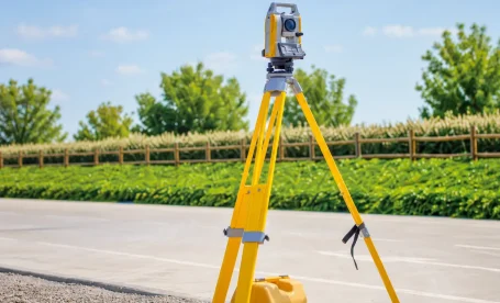
Quick answer: The Topcon GM-60 Series is a reflectorless total station built for surveyors and construction professionals who need reliable field performance. It offers non-prism measurements up to 500m, an
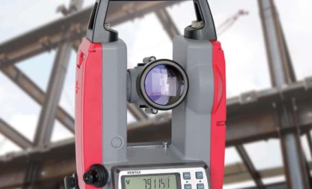
TL;DR: Electronic theodolites are precision instruments used in South African construction to measure horizontal and vertical angles with high accuracy. Their top five applications include construction site layout, building alignment,

TL;DR: There are three main types of total stations used in South Africa: manual, robotic, and hybrid. Each type suits different project scales, team sizes, and budgets. Afgen supplies all